-
Start date:
May 2017
-
End date:
Aug 2018
- Contact:
- Project site
-
Funder:
Google
Data science in local government uses novel techniques to make government more efficient in targeting resources. This project aims to explain the spread of data science methods in the local government context and to understand their impact.
Overview
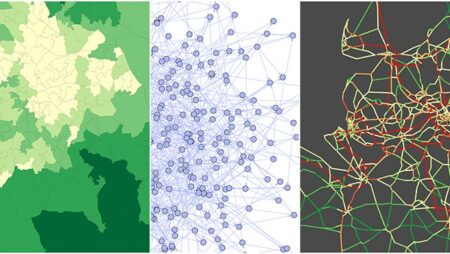
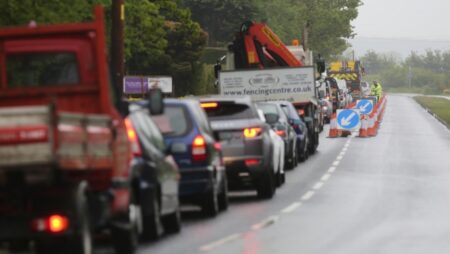
Data science in local government involves using novel techniques, such as machine learning, to harness and analyse both internal administrative data and especially data from third parties to make government more responsive to citizens and more efficient in targeting resources. For example, Lyon is one of almost 100 cities using data from the Strava cycling app to plan cycle routes; whilst Cardiff is making use of Vodafone telephone data to help manage traffic congestion, and London is using Oyster card data to optimise its underground system. The spread of data science promises to revolutionise the ability of local policymakers (who have typically operated in an information poor environment) to plan and manage their communities. It is potentially particularly revolutionary for small and medium sized cities, as it offers an alternative way of realising the “smart city” vision which does not rely on the installation of expensive sensor grids.
However, the novelty of data science as an area means that there has been almost a complete lack of academic attention to the subject. We know little about why some cities choose to take up data science methods whilst others do not. We also know little about how to overcome barriers to implementation (for example, training key staff, privacy and data protection, and contracting IT companies). Finally, there has been a lack of critical attention to the impact of novel algorithms and machine learning techniques in local government, especially when they are based on data which comes from third parties. Does data science benefit some citizens more than others? How does it alter power relations within government, and between government and the private sector? The aim of this project is to help fill in these gaps in knowledge, by both explaining the spread of data science in the local government context and understanding its impact.
Latest blog posts
-
Survey: State of the Art of Data Science in Local Government
Date Published: 30 October 2017 - 3:33 pm
Authors: Jonathan Bright
The Data Science for Local Government project seeks to map and understand the use of both novel data analysis techniques and novel data sources ...
Read More Survey: State of the Art of Data Science in Local Government -
Estimating local commuting patterns from geolocated Twitter data
Date Published: 25 October 2017 - 9:35 pm
Authors: Jonathan Bright
Over the last decade or so there has been an explosion of research interest in the area of measuring (and forecasting) of traffic and ...
Read More Estimating local commuting patterns from geolocated Twitter data -
A simple trick for drawing pseudo-geographical networks
Date Published: 21 July 2016 - 3:06 pm
Authors: Graham McNeill
Not all networks have geographic information (e.g., friendship networks, hyperlink networks, etc.). However, for networks that do have geographic data (such as networks of ...
Read More A simple trick for drawing pseudo-geographical networks
People
-
Dr Jonathan Bright
Oxford Internet Institute, University of Oxford
-
Dr Bharath Ganesh
Oxford Internet Institute, University of Oxford
Blog
-
Survey: State of the Art of Data Science in Local Government
Date Published: 30 October 2017 - 3:33 pm
Authors: Jonathan Bright
The Data Science for Local Government project seeks to map and understand the use of both novel data analysis techniques and novel data sources ...
Read More Survey: State of the Art of Data Science in Local Government -
Estimating local commuting patterns from geolocated Twitter data
Date Published: 25 October 2017 - 9:35 pm
Authors: Jonathan Bright
Over the last decade or so there has been an explosion of research interest in the area of measuring (and forecasting) of traffic and ...
Read More Estimating local commuting patterns from geolocated Twitter data -
A simple trick for drawing pseudo-geographical networks
Date Published: 21 July 2016 - 3:06 pm
Authors: Graham McNeill
Not all networks have geographic information (e.g., friendship networks, hyperlink networks, etc.). However, for networks that do have geographic data (such as networks of ...
Read More A simple trick for drawing pseudo-geographical networks -
Visualizing network data
Date Published: 11 April 2016 - 4:07 am
Authors: Scott A. Hale
Released in 2012, the sigma.js plugin for Gephi allows for the interactive display of network data in a web browser using open-source technologies, principally ...
Read More Visualizing network data -
Social and Open Data Sources and Visualisation Methods for Urban Decision Making
Date Published: 2 February 2016 - 5:18 pm
Authors: Jonathan Bright
One of the deliverables from the UrbanData2Decide project has just been published on the project website. It’s a report on social and open data ...
Read More Social and Open Data Sources and Visualisation Methods for Urban Decision Making -
Smart cities and collaborative mapping tools
Date Published: 1 February 2016 - 3:07 pm
Authors: Jonathan Bright
The UrbanData2Decide project has partly been about getting to know local government administrators and understanding more about the types of data related challenges they ...
Read More Smart cities and collaborative mapping tools -
The changing nature of big data sources as a barrier to smart city implementation
Date Published: 27 January 2016 - 4:19 pm
Authors: Jonathan Bright
Twitter is going to be a major data source for the NEXUS project, as it is for almost every other project studying social media data. ...
Read More The changing nature of big data sources as a barrier to smart city implementation -
Mapping human mobility with social media data
Date Published: 12 January 2016 - 6:15 pm
Authors: Jonathan Bright
One of the key aims of the NEXUS project is to explore the extent to which human mobility patterns (e.g. commuting, tourism, migration) can be ...
Read More Mapping human mobility with social media data