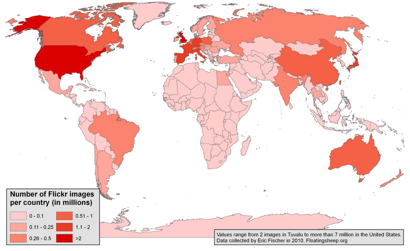
Today’s map is a visualisation of all 34 million geotagged Flickr images. The data were kindly collected by Eric Fischer and then aggregated to the country-level (an operation that took our computer about three weeks to process!).
You can see that user-generated images in Flickr display similar geographies to other types of user-generated content (e.g. Wikipedia). In the next few weeks, we’ll upload some variations of this map. These results aren’t necessarily surprising, but do just reinforce findings that subjects of user-generated content are highly concentrated in only a few parts of the world.